
To find the latitudes and longitudes of sites which you are collating the data - log onto to Google Map, right click on the location of the site and then click on the green marker and the latitude and longitude will be shown.

The following are the various sites in my school.
| Latitude | Longitude | |
| Parade Square | 1.37523 | 103.902154 |
| Field | 1.374803 | 103.901546 |
| Pond | 1.374768 | 103.902581 |
| Canteen | 1.37479 | 103.902141 |
| Basketball court | 1.374162 | 103.902117 |
A google form is generated for the group to enter the respective data they have collected:

The data which the group enter will appear on the spread sheet in Google Doc. Download it as a csv file.


Click on "import"

Import the csv file which you have downloaded earlier.

Click on" Lat of Location" and a pop up menu will appear - click on "Latitude"


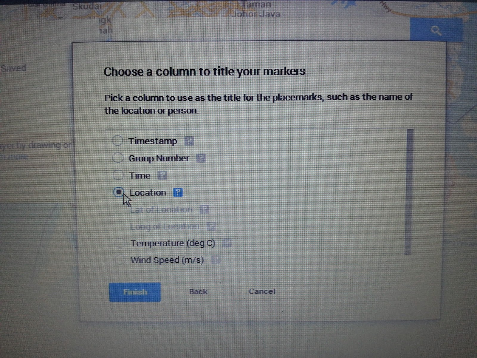
Click on "continue" and then click on " Location" and "Finish"

Click on the arrow key next to "base map" and choose "satellite" from the pop up menu.


Click on "style" then "individual style" and click on "temperatures"


You can click on "data" to view and edit the data.
