Interesting sharing by Vincent Wei Sern Lew on the use of dynamic mathematics and geometry software, in particular in using Geogebra.
The tutorials are easy and intuitive enough for students to learn without taking up too much of curriculum time as the students can explore after the teacher demonstrate the use.
Consider pedagogy of using AR to create learning experiences and using AR to help students link abstract algebra and functions to real world geometry and motion geometry
You will need to download 2 apps
ARCore by Google
Geogebra 3D graphing calculator
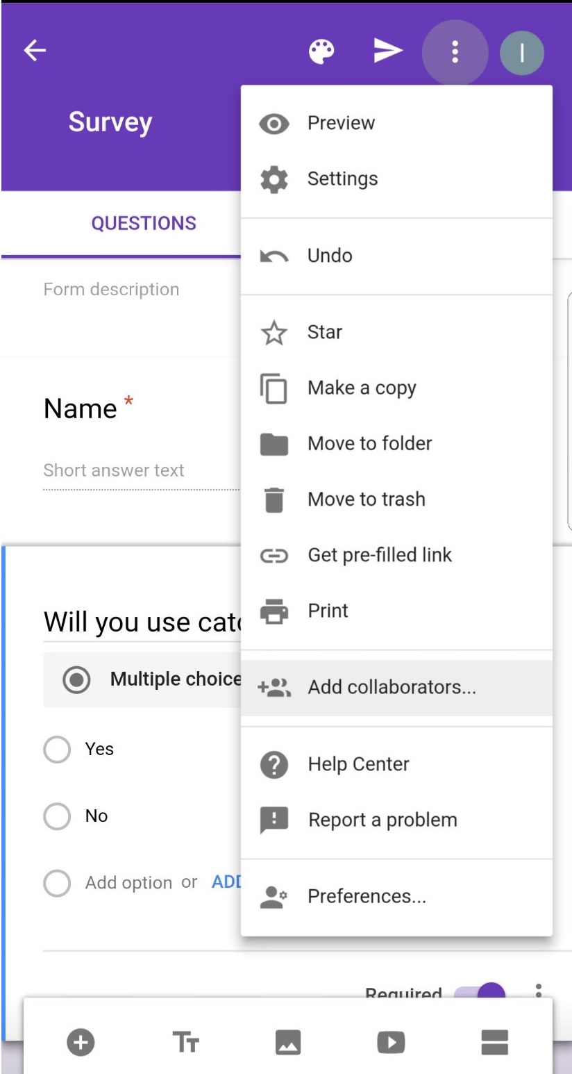
Had been using Google Form to carry out surveys which forms part of geographical investigation. Google Form is also good for collating responses. However there is a need to be connected to the internet in order to use Google Form to collect data. The android app is known as G-form for the Google Forms.
Feed2go is available in apple store ( was hoping to see it in playstore for android) and I must say it is very user friendly with the ability to enter the data offline and upload once there is internet connection.
You can chose the type of question to create - liket scale or closed questions with option
You can also choose open-ended questions with the choice of 1 line answer or longer text.
You can change the page layout in the setting from the top menu.
Once the questionnaire is completed, you can start the survey. This is what you will see on the screen - just press start and click on start.
Just fill up the responses and then it will go a page similar to the above where you can click on start to enter the responses from the 2nd respondent. Click on Finished once all the surveys are completed.
You can click on results to see the collated responses.
You can also email the responses in csv format - in which the responses captured by different groups can be collated by the team leader in Microsoft excel. Using Microsoft excel the results can be presented by inserting charts as well.
My colleague, Elisabeth, introduced me to the quiz function of Google form. Will explore that soon. Another teacher in the sg learning designer circle, Pierre , mentioned that there is a feature where you can design for a differentiated task also. For example, you have seen in some surveys, if you answer Q1, you will be directed to questions Q3. And if you answer Q2, you will be directed to Q4. This allows you to possibly design your quiz to help "direct" students who are weaker to a different set of questions. Would really love to try out and reflect on the blog soon.
Exploring the affordance of the liveboard app. It looks very promising with the ability to collaborate real time, either online or even without data with people nearby.
Watch this video on the liveboard app:
I like the fact that I can annotate on the pictures taken and then shared instantly and the students collaborate with team members in analysing the data. Thinking of using the app for geographical investigation with ipads.Digitising the task of annotating pictures or fieldsketch will make it easier for the students to work collaboratively in make amendment and addition together.
It can also record and share what is written on the screen.
Usage is simple. You can download the app via playstore or apple store. Just sign up for the account upon login. Most importantly - it is free!
It can also be shared on browser (chrome) except that the recording function will not be there - https://app.liveboard.online/
Tried it out with a small group today in explaining a lesson and realised that it is a good tool for remote teaching too. 2 students from 2 diff classes needed explanation on how monsoon affect India's climate thus I told them to download and showed them using the liveboard. from home. They clarified their doubts using the chat function. So it is useful in explaining to small groups online real time. Usage is simple too. Just start the session and invite them with the code which can be sent via WhatsApp.
The chat window is on the right hand side which made it easier to clarify any doubts the students have.
The girl find it useful as she could record the session as well. The boy was struggling and keep erasing instead of adding to the map.
The session can be saved as shown under recording as shown above.
The following is a recording of how I explained the formation and differences between stratovolcano and shield volcano to a student during a live tutorial.
As feedback by the student it is a good app as he can converse and clarify with the teacher or collaborate with other students on an idea and able to retrieve the information even after the session has ended.
The various tools on the whiteboard as shown above. I have inserted the picture first and then annotated the picture to explain to the students. You can also add participants by sending them the code.
If you are conducting a tutorial and just want to show the steps without the participants drawing on it, you can disable all drawings by clicking on user. However this function is only available on the app and not on browser version.
Checked with the Sg learning designers circle in facebook and appreciate the feedback on the use of the app from Roslee, who teaches English and Maths. He mentioned that he tried it with his remedial group and that he could share his screen to them and they can add on to his sharing. He also shared a question to the students and get them in pairs or threes at most to do while others can talk about it without the use of the projector. He also added that it is very good for ad hoc, unlike Nearpod. That's why I love the facebook community - so much to learn from each other. As I share, I learn and as I learn, I share
Love the sharing by my colleagues Elisabeth and Wen Ee today. In fact there is a need for active and collaborative instruction coupled with various
means to encourage student engagement which will invariably lead to better learning
outcome. The use of technology can help to engage the students and becoming visible learners. They shared with us the following links which contain very useful apps or website for educators. http://www.educatorstechnology.com/2017/01/70-educational-ipad-apps-for-teachers.html
A bit of "magic" using Aurasma which would definitely excite the students as they can use the app to see the picture comes alive in the form of a video. Engaging students using the app aurasma
I have learned about this 2 years ago and had wanted to try but have not done so. Decided to try a simple one using a photo of the tuned mass damper in 101 building to trigger an interesting video clip from a Taiwan news report.
You can try to use Aurasma to scan the following picture:
Just activate the app and you can scan the trigger picture. Students will be amazed how the video will suddenly come alive in VR! Try it out today!
Extracted from my earlier post on Aurasma below:
An interesting app shared during the ICT symposium 2015 - Aurasma
It can be downloaded from App Store for IOS and Play store for Androids (however my Samsung Note 4 is not compatible and cannot download it. It works on my Samsung Galaxy Pro) The app offers a lot of potential in creating virtual learning.
Aurasma allows users to create or view augmented reality experiences. The user open up the app and capture the photo with the camera. The image will transform into a video, animation, another image or bring you to a website with more information.
To create their own Auras, students or teachers choose an overlay and a trigger. An overlay is a video, image, an animation or a website link that will appear when someone finds the trigger object or photo.
I am always amazed by how mobile app can help in engaging the students in learning. This is especially so when most students own a smart phone nowadays and they could download many apps free. I have shared earlier on how mobile apps can be used for Geography - http://ezitnew.blogspot.sg/2012/06/applications-from-google-play-android.html Though the followings are mobile apps for Art and Science, I must say I was quite fascinated by them. This is especially so for Prisma which I could turn my photos into the different Art piece immediately. A great way to learn the different Art style! You can either take a photo or choose from your gallery a photo and then click on the various art filters to see them being converted in seconds! I have converted two photos which I took and I am really awed by the effects.
Another similar one is Deep Art Effects - more filters but can be quite laggy.
Using the free wRiteFormula app, students played a game to understand the nomenclature of ionic compounds. Students advanced in the game
by gaining experience points and they’d receive immediate feedback on their
performance. Asa results, Chemistry concepts came alive in an exciting form, helping students to enjoy
the process of learning that much more. https://play.google.com/store/apps/details?id=com.ixorastudios.writeformula&hl=en
Race against time to form chemical compounds (IUPAC Nomenclature) in this new and exciting educational game!
Form chemical compounds using various ions that appear in the game!
Answer multiple choice questions with the correct chemical formula and name of the compound to achieve higher scores!
Consecutively form compounds and answer questions correctly to earn huge score bonuses!
Learn from the mistakes you make during the game by looking through the game summary and feedback after a game!
• See elements in their natural state and real-life applications. • Incorporated Podcasts and videos. • Use the interactive slider to see how elements change state as temperature increases, or explore the discovery of the elements through history. • Use the simple table for quick access to data – like sorting elements in order of increasing density.
I am really amazed at how technology has advanced and the no. of apps for smart phone or tablets I could use in my Geography lessons. I used to have to bring quite a no. of instruments for fieldwork e.g. ranging poles, clinometer and compass. In the latest field inquiry course which I attended, I downloaded the clinometer, stop watch and smart compass to my handphone and tablet. By using theclinometer, we could actually measure the gradient of the beach easily. At every 1m interval, we measured the gradient by placing the phone/tablet on the beach and recorded the gradient. We were able to plot the beach profile from all the data collected. We realised that the gradient was steeper on one side of the beach behind the breakwater and suspected there is a drift of sediments towards the east - we had usedcompassapplication to determine our location. I realised that if we want to use the ranging poles and clinometer to measure angle - the smart protractor would be useful as well. We also decided to check on the wave energy and determine whether the wave energy is high and the need to construct the breakwater to reduce the energy before it hits the coast. Using the stopwatch and timer we time the no. of waves per min. True enough the count was 20 per min which indicated high wave energy. Another useful application would be the smart measure which we could measure the height of the breakwaters or the distance between them. It seemed that the breakwaters over our stretch of coast are slightly higher and nearer to each other.
Sketching for geographical inquiry - you can use the app Sketchart or protrait sketch to turn your image into a sketch instantly!
Sketch guru is also very useful in creating a field sketch instantly.
Of course, many people would have found Google Map useful. Whenever I am at a new place, I will use it to help me to navigate around. You must also install Street View on Google Map. With Google Maps Street View, you can explore the world at street level. Just open Google Maps, search for a place or long-press the map, and tap the Street View option.
You can measure the area and distance on Google Map usingArea Calculatorwhich is relatively easy to use as shown below:
Use Google Earth to fly around the planet with the swipe of a finger. Search by voice for cities, places, and businesses. Browse layers including roads, borders, places, photos and more. For tablet users (Android 3.0 or newer), you can get easy access to search, reset-to-north, my location, and layers. Also, on tablets and select phones, you can now explore the same photo-realistic 3D buildings that have previously only been accessible with the desktop version of Google Earth.
Another application which you must have isGet Altitude- it not only shows you the Altitude but also the longitude and latitude - sometimes I feel that the location is even more accurate compared to Google Map.
I also like Earth Zoom Pro - you can zoom from Space to Ground level to famous places such as Machu Picchu, Petra, The Forbidden City, Pyramids, Taj Mahal More
Google Goggles is another useful application which could help me to identify an object.
The following are some useful apps on weather studies -
The weather channel allows one to track the weather conditions and forecast around the world and you can choose the layer as well as the type of map. There are also videos related to videos as well.
Weatherlah keeps all Singaporeans up to date about the latest weather forecast with a clean and easy to use interface. The app can notify you of incoming rain, rise in PSI levels and even extreme weather warnings.You can also click on drain in the map mode to see whether the drains are flooded or low in water level around Singapore.
Wind speedis a wind convertor which allows you to convertbetween many various wind speed measurement scales e.g. Beaufort scales to km per hour .Click on the i icon and you can find out more what the scale represent e.g. on Beaufort scale 5 leaves begin to sway and on beaufort scale 10 trees are broken off or uprooted.
T-counter is very useful in counting traffic - you can have 4 counters at the same time e.g. one for car, one for bus, one for taxi and one for others! just touch the + button to add on. Good for field inquiry in Human Geography for human traffic as well.
Another tool useful for human geog istape-a-talk which is useful for interviews. The recording is saved in wav file and can be played back on computers. Of course you could also use the camera function on your phone but some people might not want to be captured on video.
You can create a dropboxaccount on your computer as well as download the dropbox apponto your handphone and the files can all be uploaded and share.
I also like Kingoffice which allows you to view as well as edit office documents - words, excel, powerpoint.
Another amazing application is 3D Earthquake. Like what I have told my students - earthquakes occur everyday - just that the magnitude might be small and not reported in the news. It shows the plate tectonic - that the plates are moving and you can change the setting to show the plate boundaries and how these earthquakes coincides with the plate boundaries.
Simearthquake is another app which is very good to illustrate how magnitude affects the extent of damage from earthquake.
Volcano reportis also an interesting app to know the latest volcanic eruptions in the world. Explore volcanoes which have been active in the last week on an interactive map. For every single volcano you get detailed information about the ongoing activity and their eruptions.
Of course as a geography teacher, the app World Mapand National Geographic Explorer are also indispensable. However I could not add National Geographic Explorer to my Motorola Xoom - only on my husband's Lenovo K1
Learn more about Geography Natural and Man-made Features - Natural features part 1 and part 2, Man-made features part 1and part 2. There are also many other apps on Geography games and quiz. And of course the best part about all these apps are that they are free!