We opened our classroom for teachers from another school to show how our students used their personal learning devices in class.
We had started on 𝟭:𝟭 𝗣𝗲𝗿𝘀𝗼𝗻𝗮𝗹 𝗟𝗲𝗮𝗿𝗻𝗶𝗻𝗴 𝗗𝗲𝘃𝗶𝗰𝗲 using iPad in 2019 and it was a real blessing for 2010. I must thank our HOD ICT in rolling out the 1:1 PLD program and also ensuring the infrastructure support such as 𝗔𝗽𝗽𝗹𝗲 𝗧𝗩 so that we can mirror our iPad screen to the projector screen easily.
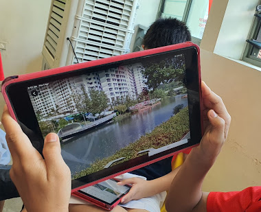
Of course I am also thankful that we are already on the 𝗚𝗼𝗼𝗴𝗹𝗲 𝗦𝘂𝗶𝘁𝗲.The ease of organising the lessons via the 𝗚𝗼𝗼𝗴𝗹𝗲 𝗖𝗹𝗮𝘀𝘀𝗿𝗼𝗼𝗺 and the ability for the students to use technology in their learning. The Sec 3 had fun on an overseas virtual fieldwork in UK and made interesting findings on 𝗚𝗼𝗼𝗴𝗹𝗲 𝗘𝗮𝗿𝘁𝗵. The Sec 1 love that they can explore the field sites along the Punggol waterway from their seats using 𝗚𝗼𝗼𝗴𝗹𝗲 𝗘𝗮𝗿𝘁𝗵. They would have gotten all wet if they had gone there for their GI as it started raining so heavily.
Sec 1
We completed stage 4 of our Water GI using 𝗚𝗼𝗼𝗴𝗹𝗲 𝗖𝗹𝗮𝘀𝘀𝗿𝗼𝗼𝗺, 𝗚𝗼𝗼𝗴𝗹𝗲 𝗘𝗮𝗿𝘁𝗵 as well as 𝗚𝗼𝗼𝗴𝗹𝗲 𝗦𝗹𝗶𝗱𝗲𝘀 for collaboration. I have placemarked the field sites and embedded the data they had collected from their water test. The groups entered the data into 𝗚𝗼𝗼𝗴𝗹𝗲 𝗙𝗼𝗿𝗺 and the teachers were able to help the classes collate their data for the to analyse on the 𝗚𝗼𝗼𝗴𝗹𝗲 𝗦𝗽𝗿𝗲𝗮𝗱𝘀𝗵𝗲𝗲𝘁. They were able to make observations of the field sites using the street view and explained how the features they have observed on 𝗚𝗼𝗼𝗴𝗹𝗲 𝗘𝗮𝗿𝘁𝗵 showed human activities and the impacts on the waterway. They are able to collaborate with their members to present the conclusion on their GI using 𝗚𝗼𝗼𝗴𝗹𝗲 𝗦𝗹𝗶𝗱𝗲𝘀. https://sites.google.com/a/moe.edu.sg/sec-1-geog-2021/2021-water-gi
To show the changes overtime I have also used Juxtapose JS to create a time slider using 𝗚𝗼𝗼𝗴𝗹𝗲 𝗘𝗮𝗿𝘁𝗵 images from 2010 and 2020.
Was a bit apprehensive carrying out the same lesson with a sec 1 NA class but I was so pleasantly surprised that they showed more enthusiasm. As they visited the site using Google Earth, many were excited and asked Mrs Lily, is this the oxygen pump? Is this the aquatic plants that purify the water? Is this the turbidity barrier? Teacher, this construction site has a fence, so the soil will not be washed into the river? Teacher do we only write the bad things which affect the water or we can write on the good ones? Teacher I live there, the construction of the block is already completed, why does it still show a construction site?
I was bombarded with so many questions and at the same time feel happy that they are asking questions cos that is part of inquiry based learning. Definitely engaged as they take ownership in collecting the data (evidence) in this geographical investigation.
I think it's a joy to see them having fun in learning, discovering more about the environment around them.
For this I am grateful with the use of technology. 😊
In fact I learned from them too, as they are so proud of their findings, I get them to screenshot the Google Earth images into their slides as evidence. Original plan was just for them to write on their findings but learned from them that I should let them include as evidence for their conclusion. Will definitely change that for all classes next year.
Sec 3 We used Google Earth to understand coastal studies for map reading. I have integrated a topographical map into the 𝗚𝗼𝗼𝗴𝗹𝗲 𝗘𝗮𝗿𝘁𝗵 file. The students visited the south of UK (Seaton) and learn how the map representation came alive with 𝗚𝗼𝗼𝗴𝗹𝗲 𝗘𝗮𝗿𝘁𝗵 showing them the actual site of coastal landforms they have studied. They also better understand the concept of space, scale and place as they made measurements of the spit and made observations of how the spit has affected human activities in the area. https://sites.google.com/a/moe.edu.sg/sec3geog/google-earth
This was continued from the Coastal GI using 𝗚𝗼𝗼𝗴𝗹𝗲 𝗘𝗮𝗿𝘁𝗵, 𝗚𝗼𝗼𝗴𝗹𝗲 𝗦𝗽𝗿𝗲𝗮𝗱𝘀𝗵𝗲𝗲𝘁 and 𝗚𝗼𝗼𝗴𝗹𝗲 𝗦𝗹𝗶𝗱𝗲𝘀 on 15 Mar. With Google Earth, the students visited the place marked field sites and made observations of the environment. They annotated a field sketch to explain the coastal processes which could have affected their investigation. It is blended learning as I also included the fieldwork simulation of measuring the sediments I had collected. They did the wave frequency via a pre-recorded video. They also measured the gradients on the models I have created. https://sites.google.com/a/moe.edu.sg/sec3geog/geographical-investigation/gi---coast/2021-coastal-gi-fieldwork-simulation
Updated 3 April
Google Earth provides opportunities to explore geographical issues such as Climate Change.
Other than the Google Earth kmz file 4 degrees which shows areas most affected by global warming in terms of temperature changes.
Students can explore cities which will be most impacted by the rise in sea level in the simulation with Voyager in Google Earth.
The file on sea level rise and the fate of coastal cities can be found under the category Nature in Voyager.
Showing the spatial extent of impact with a 2 degree increase in global temperature as compared to a four degree increase on Mumbai in India.
Love the 3D enactment of the coastal flooding of the cities with sea level rise.


