Showing posts with label Google Earth. Show all posts

Mar 26, 2024

Voyager in Google Earth

Voyager in Google Earth has moved. It's no longer available in the main app but showcased on the website.

Explore the stories on the gallery here. Love the one on sea level rise and changing forests.

https://www.google.com/earth/about/gallery/


https://www.google.com/earth/education/


Nov 10, 2022

Voyager in Google Earth App

I have been using Google Earth and have written on the use of it earlier. Here I would like to expand more on the use of Voyager in the Google Earth App as many students are using the Google Earth app in their mobile devices such as iPad.

The use of Google Earth has been great to understand the concepts of Space, Scale, Place and Environment in Geography

Games in Voyager

You can click on the wheel like icon to access Voyager. One of the category in Voyager is GAMES. I have recently gotten the students to play the game Where is Carmen Sandiego. 

When students click on an interviewee in the game, they will automatically zoom-in on the location of the interview. Just like in any other use of Google Earth, the students can zoom and pan around the area of detail.
Great for learning about places around the world! After talking to the witnesses, the students have to use the information to make their best guess as to where they should fly to next from a given list to pursue Carmen Sandiego.

A second version 
Tutankhamun’s Mask and a third version Keys to the Kremlin are also available under GAMES in Voyager. 

As the students play the game, they learn the names of the places they visit virtually. They can learn the uniqueness of the place which attract tourists and were reminded to relate it to what they have learned in the topic on tourism:
Places which attract tourists
Places of scenic beauty
Places with rich culture
Places with facilities
Places with conflicts

The Quiz on Transport is also great as a trigger for the topic on transport for Sec 2


Another category under voyager is LAYERS. I love the one on Current Hurricanes & Tropical Storms which show the path of recent hurricanes and tropical storms. Tsunamis in History help students to see how large volcanic eruptions and underwater earthquakes can result in Tsunamis which impact on many regions. The students would acquire a greater sense of the scale of impact from the phenomena. 


Especially useful will the Timelapse in Google Earth under Layers


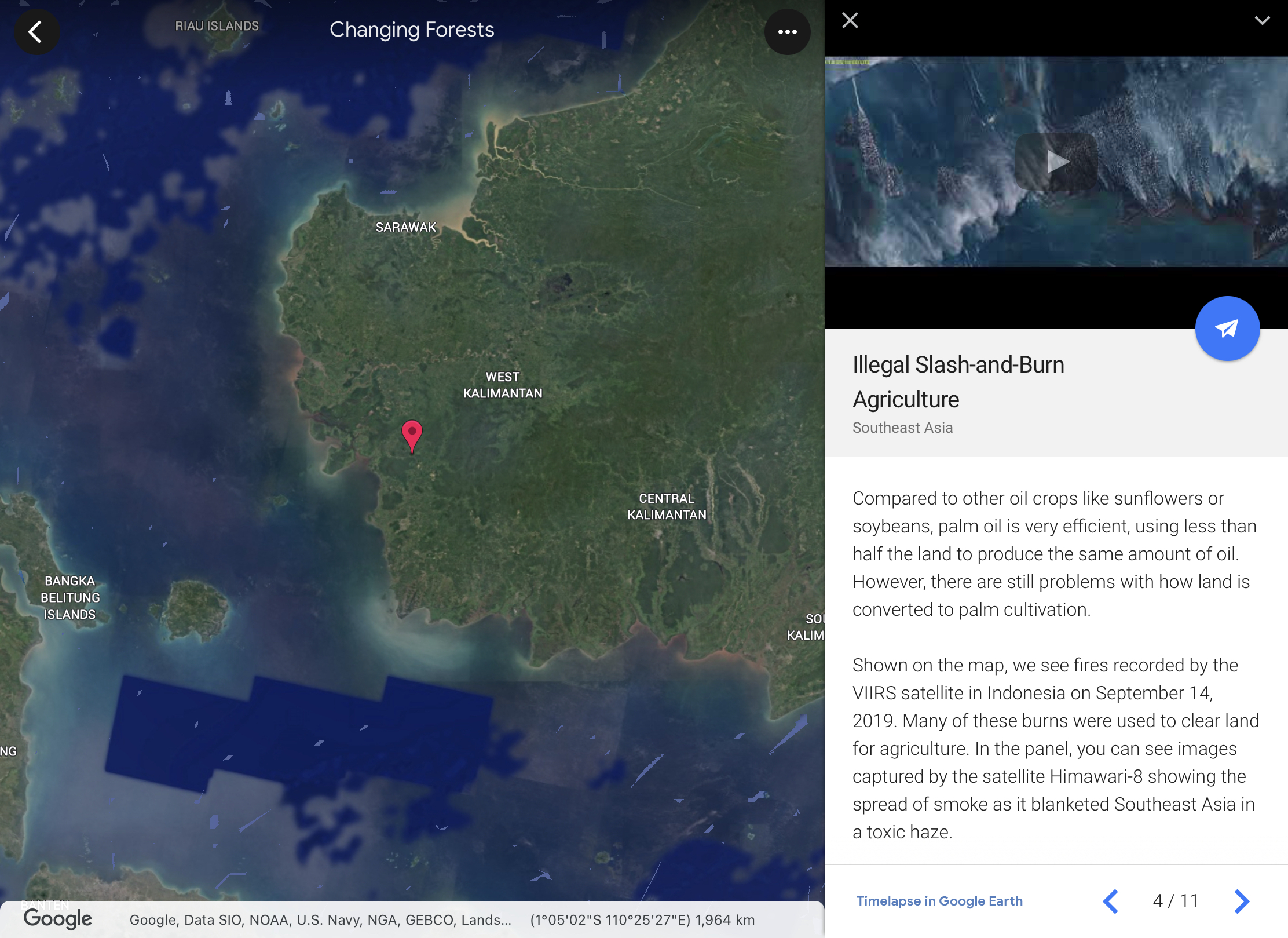
Love the one on Changing Forests under Timelapse in Google Earth. One can observe the changes over time on the changing landuse and how it impact on the forests in different parts of our Earth. The students will be able to investigate and respond to the geographical issue of deforestation in different parts of the world with a better understanding of Place, Space, Scale and Environment. 

You can also access the Google Earth Time lapse on system browser:


The students can explore the unique Earth's ecosystem which is covered in the new upper sec syllabus. Exploring the function, impacts and restoration of Earth's ecosystems under EDUCATION in Voyager


Students can continue to explore on the culture category in topics such as Orang Asal Indigenous Lands of Malaysia.


Voyager in Google Earth will allow the students to explore the world and have a better understanding of Place, Space, Scale and Environment. 

Priya shared in SGLDC how she used Voyager in Google Earth for situationall writing.


Apr 22, 2021

Google Earth for History

 I think it will definitely engage the students with virtual overseas LJ using Google Earth.

Under Culture in Voyager, students can choose to visit the WWI sites and learn more about the events there. Below are screenshots from the Voyager in Google Earth on WWI: Around the Globe. A collaboration with History Channel. 


Under Street View in Voyager, explore 360 views of WWII Memorials around the world!


Test your knowledge of the battles and events that took place during WWI and WWII using Google Earth. Visit the Places using the placemarks.


Apr 17, 2021

Timelapse on Google Earth

Excited that timelapse can now be viewed on the Google Earth app. I have always love to show the students how changes occur over time using the time slider on the desktop Google Earth. Now students can explore timelapse on their iPad too!

To explore Timelapse in Google Earth you can access the tool directly by going to g.co/Timelapse   or you can open Google Earth app.
  1. Click on the "Voyager" button in the toolbar (the button looks like a ship's steering wheel).
  2. From the "Voyager" screen you can now click on the tab for "Timelapse in Google Earth".
  3. This will now open the Timelapse feature in Google Earth, which includes the Timelapse panel on the right side or at the bottom depending on your device.
  4. You can type in any location on Earth that you would like to explore in search.
  5. Or click on the "Stories" tab. Here you will find guided tours that will take you to locations around the world where you can explore the changes through Timelapse. The stories include "Changing Forests", "Fragile Beauty", "Souces of Energy", "Warming Planet", and "Urban Expansion".
  6. Or click on the "Featured Locations"  where you will find collections of locations around the world in categories such as "Agriculture", "Deforestation", "Glaciers", "Infrastructure", and many more.
Search Locations and Stories


Featured locations


In addition to the Timelapse feature inside of Google Earth, Google has also created a site with over 800 prerendered videos of timelapses from all around the world. You can access these at http://g.co/TimelapseVideos

A tutorial on the Timelapse feature in Google Earth


Information from

Apr 1, 2021

Google Earth for Geography

 We opened our classroom for teachers from another school to show how our students used their personal learning devices in class. 

We had started on 𝟭:𝟭 𝗣𝗲𝗿𝘀𝗼𝗻𝗮𝗹 𝗟𝗲𝗮𝗿𝗻𝗶𝗻𝗴 𝗗𝗲𝘃𝗶𝗰𝗲 using iPad in 2019 and it was a real blessing for 2010. I must thank our HOD ICT in rolling out the 1:1 PLD program and also ensuring the infrastructure support such as 𝗔𝗽𝗽𝗹𝗲 𝗧𝗩 so that we can mirror our iPad screen to the projector screen easily. 

Of course I am also thankful that we are already on the 𝗚𝗼𝗼𝗴𝗹𝗲 𝗦𝘂𝗶𝘁𝗲.The ease of organising the lessons via the 𝗚𝗼𝗼𝗴𝗹𝗲 𝗖𝗹𝗮𝘀𝘀𝗿𝗼𝗼𝗺 and the ability for the students to use technology in their learning. The Sec 3 had fun on an overseas virtual fieldwork in UK and made interesting findings on 𝗚𝗼𝗼𝗴𝗹𝗲 𝗘𝗮𝗿𝘁𝗵. The Sec 1 love that they can explore the field sites along the Punggol waterway from their seats using 𝗚𝗼𝗼𝗴𝗹𝗲 𝗘𝗮𝗿𝘁𝗵. They would have gotten all wet if they had gone there for their GI as it started raining so heavily. 

Sec 1 

We completed stage 4 of our Water GI using 𝗚𝗼𝗼𝗴𝗹𝗲 𝗖𝗹𝗮𝘀𝘀𝗿𝗼𝗼𝗺, 𝗚𝗼𝗼𝗴𝗹𝗲 𝗘𝗮𝗿𝘁𝗵 as well as 𝗚𝗼𝗼𝗴𝗹𝗲 𝗦𝗹𝗶𝗱𝗲𝘀 for collaboration. I have placemarked the field sites and embedded the data they had collected from their water test. The groups entered the data into 𝗚𝗼𝗼𝗴𝗹𝗲 𝗙𝗼𝗿𝗺 and the teachers were able to help the classes collate their data for the to analyse on the 𝗚𝗼𝗼𝗴𝗹𝗲 𝗦𝗽𝗿𝗲𝗮𝗱𝘀𝗵𝗲𝗲𝘁. They were able to make observations of the field sites using the street view and explained how the features they have observed on 𝗚𝗼𝗼𝗴𝗹𝗲 𝗘𝗮𝗿𝘁𝗵 showed human activities and the impacts on the waterway. They are able to collaborate with their members to present the conclusion on their GI using 𝗚𝗼𝗼𝗴𝗹𝗲 𝗦𝗹𝗶𝗱𝗲𝘀. https://sites.google.com/a/moe.edu.sg/sec-1-geog-2021/2021-water-gi 

To show the changes overtime I have also used Juxtapose JS to create a time slider using 𝗚𝗼𝗼𝗴𝗹𝗲 𝗘𝗮𝗿𝘁𝗵 images from 2010 and 2020.


Was a bit apprehensive carrying out the same lesson with a sec 1 NA class but I was so pleasantly surprised that they showed more enthusiasm. As they visited the site using Google Earth, many were excited and asked Mrs Lily, is this the oxygen pump? Is this the aquatic plants that purify the water? Is this the turbidity barrier? Teacher, this construction site has a fence, so the soil will not be washed into the river? Teacher do we only write the bad things which affect the water or we can write on the good ones? Teacher I live there, the construction of the block is already completed, why does it still show a construction site? I was bombarded with so many questions and at the same time feel happy that they are asking questions cos that is part of inquiry based learning. Definitely engaged as they take ownership in collecting the data (evidence) in this geographical investigation. I think it's a joy to see them having fun in learning, discovering more about the environment around them. For this I am grateful with the use of technology. 😊 In fact I learned from them too, as they are so proud of their findings, I get them to screenshot the Google Earth images into their slides as evidence. Original plan was just for them to write on their findings but learned from them that I should let them include as evidence for their conclusion. Will definitely change that for all classes next year.


Sec 3 

We used Google Earth to understand coastal studies for map reading. I have integrated a topographical map into the 𝗚𝗼𝗼𝗴𝗹𝗲 𝗘𝗮𝗿𝘁𝗵 file. The students visited the south of UK (Seaton) and learn how the map representation came alive with 𝗚𝗼𝗼𝗴𝗹𝗲 𝗘𝗮𝗿𝘁𝗵 showing them the actual site of coastal landforms they have studied. They also better understand the concept of space, scale and place as they made measurements of the spit and made observations of how the spit has affected human activities in the area. https://sites.google.com/a/moe.edu.sg/sec3geog/google-earth 

 This was continued from the Coastal GI using 𝗚𝗼𝗼𝗴𝗹𝗲 𝗘𝗮𝗿𝘁𝗵, 𝗚𝗼𝗼𝗴𝗹𝗲 𝗦𝗽𝗿𝗲𝗮𝗱𝘀𝗵𝗲𝗲𝘁 and 𝗚𝗼𝗼𝗴𝗹𝗲 𝗦𝗹𝗶𝗱𝗲𝘀 on 15 Mar. With Google Earth, the students visited the place marked field sites and made observations of the environment. They annotated a field sketch to explain the coastal processes which could have affected their investigation. It is blended learning as I also included the fieldwork simulation of measuring the sediments I had collected. They did the wave frequency via a pre-recorded video. They also measured the gradients on the models I have created. https://sites.google.com/a/moe.edu.sg/sec3geog/geographical-investigation/gi---coast/2021-coastal-gi-fieldwork-simulation

Updated 3 April
Google Earth provides opportunities to explore geographical issues such as Climate Change.
Other than the Google Earth kmz file 4 degrees which shows areas most affected by global warming in terms of temperature changes.

Students can explore cities which will be most impacted by the rise in sea level in the simulation with Voyager in Google Earth
The file on sea level rise and the fate of coastal cities can be found under the category Nature in Voyager.


Showing the spatial extent of impact with a 2 degree increase in global temperature as compared to a four degree increase on Mumbai in India.


Love the 3D enactment of the coastal flooding of the cities with sea level rise.


Mar 16, 2021

SGLDC virtual meet III

Grateful for the opportunity to host one of the sessions. As I shared on how to use Google Earth, I learn too! 

One of the participants, Saravanan, asked if the ruler can be used to measure radius of a circle. I have always been using the ruler to measure distance e.g. the length of the spit or the breakwater and has never cross my mind to use the ruler to measure a circle or other shapes. To my pleasant surprise, it can do so - one area which our colleagues teaching Mathematics can tap on to get the students to see Maths at work in the real world. That's why I love to share - cos I learn too. 


Another participant is a history teacher and is keen to try creating the kmz files for her students to see the historical events in real places. You can also create tour in Google Earth as you "fly" from one place mark to another with the sound recording. I showed the participants how they could embed information, pictures and even videos into the placemark. You can get the students to create too but they would need a desktop. There are also Fairy tales and WWI &II quizzes created using Google Earth. Check out all my posts on Google Earth. http://ezitnew.blogspot.com/search/label/Google%20Earth 

 I love Google Earth as it can show historical images. I have screenshot two images - one in 2010 and another 2020 to show the development of the areas near the Punggol Waterway. I used Juxtapose JS to create a time slider which the students love. https://cdn.knightlab.com/libs/juxtapose/latest/embed/index.html?uid=104011ce-63bb-11eb-83c8-ebb5d6f907df 

I am still learning and as I learn, I share. Of course as I share, I learn too. 

You are welcomed to leave a feedback at https://tinyurl.com/lilyty after which you will automatically receive a thank you card. This is done via certify'em, an add on to google form. My students love the certificates after they completed a quiz or checklist. I have modified it so that it auto send a thank you card to replace the cert. Try it out! Thank you.


All the meet slides and recordings:

https://drive.google.com/drive/mobile/folders/1bHuERX2qyaoC2GoG37yF2eoftkEycqsy


Nov 24, 2020

SGLDC Virtual Meet II

Just some reflection on our sharing in SGLDC Virtual Meet II on 23 Nov 2020.

The SGLDC team should be sharing all the video recordings and slides of what had been shared soon. For those who have yet to join the SGLDC Facebook group (only for MOE staff) do join in and check out what the others have generously shared! 

I like that Madeline has touched on CCPD 360 resources as well as the use of Kuula in adding information to 360 images to give the students a more enriched virtual learning experience. I have shown how Google Earth can be used with other Google tools in VR simulations. Both our sharing are more teacher centric with resources the teachers can use and create for their students. Theophillia sharing is more student centric as she empowered her students to create using VR devices and the Cospaces Edu app. This enable the students to create a personalised VR learning experience and to attain the highest cognitive process on Bloom's taxonomy. 

I would also like to thank 赖世雄 for suggesting the following questions which we would have loved to ask our participants and all of you in our SGLDC family: 

In today’s education system (disrupted by Coronavirus pandemic) which physical and digital dimensions (blended approach) are evolving and combining in new ways, is the way you(we) teach still up to date? 

You have seen some examples (see), Has today’s sharing spark budding innovative e-pedagogies? (Think) what are you wondering (wonder). How could we leverage digital technologies to make education more accessible to and personalised for our students? 

What are some challenges which you foresee and has we have yet to explore / blindsided / encountered. Does our curriculum equip our next generation with the skills they will require in the future? How should we assess these skills? 

 The following is my own personal response to the above questions: 

 For the first question, I like the see, think and wonder part which I would love to hear from all. As for the one on up-to-date, I feel that it's more on necessity. The need to tap on the use of technology for blended learning is going to be a norm. How can we ease both the students and teachers into it? How can teachers collaborate and grow as we learn from each other? Madeline has brought in a wonderful idea of collaboration by forming NLC with our nearby schools. I prefer a "usable by all" approach. I like to create resources and share the use of ICT which are simple and free to use so that more teachers can be on board. I am grateful that teachers have built on what I had shared which in turn have helped me to build up my teaching and learning. 

 For the second question, I would like to put forward the challenge of differentiated learning. I am grateful for the availability of subgroups in SLS which I have yet to try. I have used Google classroom for Differentiated Instructions. I think DI is going to be another essential pedagogy we have to work on with technology moving forward with full subject based banding. For the third question, I would love to see the interdisciplinary approach and collaboration of our colleagues from different departments. Theophilia mentioned that the use of VR to empower the students is used in EL and Science too. 

 赖世雄 also shared this useful website on VR https://www.classvr.com/school-virtual-reality-news/educational-vr-lesson-ideas/ 

Thank you 赖世雄 And definitely BIG thanks to Madeline and Theopillia! 

And a side note, Google Earth is useful for other subjects such as Literature, History and even Maths too!  

http://ezitnew.blogspot.com/2020/03/fairy-tales-with-google-earth.html 

http://ezitnew.blogspot.com/2019/02/maths-in-google-earth.html 

http://ezitnew.blogspot.com/2019/03/google-earth-detective-game.html


Nov 14, 2020

Creation tools in Google Earth

 I have been creating kmz files for my studies for enquiry based learning and virtual GI.

We can also get the students to create a tour using Google Earth. This will be useful especially in story telling and the topic on tourism.


One advantage of using Google Earth for projects is that they can share their project and collaborate with other students.

10 ways to use Google Earth with students by freetech4teachers

https://www.freetech4teachers.com/2017/05/10-ways-to-use-google-earth-in-your.html?m=1

How I use Google Earth in Geography:

You can also see my other posts on Google Earth by clicking on the label "Google Earth" below


May 2, 2020

Virtual learning journey

The video below is a 360 video of the Chinatown LJ for Tourism GI 2020. You can also move horizontally through the 360 video by dragging your finger across the screen if you are using your handphone. You may also pause the video and swipe on the screen for the 360 view. Though you cannot experience the smell, the sight and sound would be an amazing VR experience.


You can watch it in VR if you open up the video in YouTube. Experience the virtual reality with VR glasses. Virtual Tourism GI


More of 2020 tourism GI here 


Did a virtual Coastal GI in UK too using Google Earth. An overseas virtual learning journey!
Gotten the students to make observation using street view as well using the ruler in Google Earth to do measurements. I actually gotten the students to 'fly' back to Singapore to compare the size of the one we have at ECP with that in UK. Gotten them to think why are the breakwaters wider in UK.
Google Earth Kmz file and worksheet I have created can be downloaded from my Google site@

Sec 1 virtual Water GI using Google Earth. Let's fly over to Lorong Halus!
Students learn more about the history of the place.
https://sites.google.com/a/moe.edu.sg/sec-1-geog/geographical-investigation/5-lorong-halus-wetlands

They can also see how the place was in the past using the time slider with Google Earth.
https://sites.google.com/a/moe.edu.sg/sec-1-geog/google-earth

Then visit the various location via the street view on Google Earth.


For sec 2 we actually gotten the students to annotate a picture of their neighbourhood to show why it is a unique place for them. Some were not able to be there so they made use of Google Earth and screenshot the street view. They drag the pegman to the spot where there is blue line to see the area in street view.


Updated  5 June- Alex shared on the following 360 video of the Toa Payoh Neighbourhood.


This also reminded me of the sharing on using VR for Housing GI shared by Hua Yi sec
http://geogshare.blogspot.com/2019/11/vr-in-geography.html

Updated Aug 2020: Use of VR by Ms Yong from Teck Whye Sec
https://www.schoolbag.edu.sg/story/first-person-real-issues-virtual-classroom

Do also look at my earlier post on the use of MOE arcgis resources.
http://geogshare.blogspot.com/2020/03/arcgis-resources.html

I have always love Google Earth - My earlier posts on the use of Google Earth:
http://ezitnew.blogspot.com/search/label/Google%20Earth

The use of Google Earth definitely encourage real world exploration. It enables the students to overcome the constraints of space and time, bringing the world into the classroom. Google Earth allows students to locate and explore different parts of the world and the time slider allow one to compare the before-and-after images of an area.   This can definitely help to spark curiosity about the causes and impacts of change as what I have mentioned earlier about the Sec 1's study of Lorong Halus.  

In instances where the location of a study is difficult to reach, teachers can take students on virtual tours. Virtual tours may be in the form of the drag and drop Pegman icon on Google Street View's 3D view. The students could take a virtual trip to see why Machu Picchu in Peru attracts the tourists by moving around the ruins left by the Inca civilisation as well as experience the amazing view from the mountain top. 

Students can zoom, pan, and rotate the orientations of their screen in Google Earth to help them understand geographical space, place, and scale. As mentioned above, the students can use the search and zoom functions on Google Earth to explore Lorong Halus. The ability to observe features in Google Earth by manipulating the map scale actively and easily allows students to have a better sense of how the waterway, e.g Punggol waterway, are connected at a locale and even factors that may affect the water quality in the waterway. 

My Sec 3 students have also enjoyed measuring the breakwater in UK and compare that to the one at ECP using the ruler function in Google Earth. In doing so they could better understand the geographical concept of scale as well as making observations on the reasons for the difference in sizes.  Spatial analysis could be carried out and exploration of the real world without them actually being there with virtual field trips!

I have created a Virtual Coastal GI using Google Earth and simulations in school.
You can read more here: